
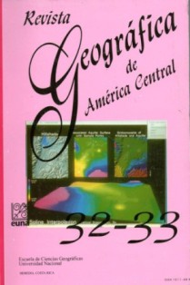
USO Y COBERTURA DE LA TIERRA EN COSTA RICA PARA 1992: UNA APLICACIÓN DE TELEDETECCIÓN ESPACIAL Y SISTEMAS DE INFORMACION GEOGRÁFICA
Resumen
En el presente artículo se describe el procedimiento utilizado para actualizar el mapa de uso y cobertura de la tierra de Costa Rica para el año 1992. En el proceso se integró la cartografía análoga existente para 1985 a escala 1:200.000 e imágenes digitales del Mapeador Temático de LANDSAT para los años 1991 y 1993. Para comprobar la exactitud de la clasificación se usaron 1.372 puntos obtenidos de fotos aéreas de 1992 y trabajo de campo empleando un Sistema de Posicionamiento Global (SPG). Los resultados obtenidos indican que existe un 46.6% del país bajo pastos, un 32,9 bajo bosques y un 8,5% bajo uso agrícola. Un 7,8% del área se incluyó en una categoría denominada <<no clasificada, usos mezclados, deforestada>>. La exactitud global de la clasificación fue de un 74%; con una confusión entre pasto y bosque de un 19%.
SUMMARY
The objective of this paper is to describe the process used by the authors to update the preliminary 1985 land use-land cover map of Costa Rica. Paper maps of 1985 at scale 1:200.000 we digitized, rasterized and use to label the output of a nonsupervised classification carried out using 1991-93 digital data from LANDSAT 5 (Thematic Mapper). Aerial photography and field work aided by a Global Positional System (GPS) was used to gather ground-truth data. A total of 1372 stratified points were used to test the accuracy of the final map. Our results showed that 46,6% of the country is under pasture, 32,9% under forest and 8.5% under agriculture. The nonclassified areas were lumped into one category that accounted for 7,8% of the country. Global accuracy of the classification was 74% with the confusion between forest and pasture accounting for 19% of this error.
Descargas
Cómo citar
Número
Sección
Licencia
Política propuesta para Revistas que ofrecen Acceso Abierto
Los autores que publican en esta revista están de acuerdo con los siguientes términos:
a. Los autores conservan los derechos de autor y garantizan a la revista el derecho de ser la primera publicación del trabajo, bajo la Licencia https://creativecommons.org/licenses/by-nc-sa/4.0/deed.es, que permite a otros compartir con un reconocimiento de la autoría del trabajo y la publicación inicial en esta revista.
b. Los autores pueden establecer por separado acuerdos adicionales para la distribución no exclusiva de la versión de la obra publicada en la revista (por ejemplo, situarlo en un repositorio institucional o publicarlo en un libro), con un reconocimiento de su publicación inicial en esta revista. Esos acuerdos adicionales deben respetar los términos de la licencia: es decir: no involucrar fines de lucro y compartir con la misma licencia.
c. Se anima a los autores a archivar el post-print o versión de editor/PDF en repositorios de acceso abierto.


 REVGEO se encuentra bajo la licencia https://creativecommons.org/licenses/by-nc-sa/4.0/deed.es

